 Camilla Jessen
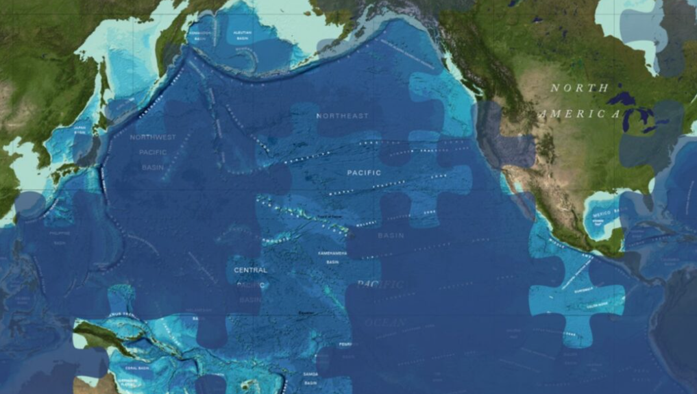
The ambitious project has recently hit a major milestone in its endeavor.
A cliché among oceanographers is that humanity knows more about the surface of Mars than we do about the Earth’s ocean floor.
The ambitious Seabed 2030 project wants to change that.
Addressing this informational gap, a team of researchers has dedicated the past six years to mapping the seabed, and they’ve just celebrated a significant achievement.
A Deep Dive into the Unknown
The Seabed 2030 project has successfully mapped the first 25% of the seabeds of the world’s seven oceans.
This recent progress enabled the discovery of four so-called seamounts off the coast of South and Central America.
One of these underwater mountains rises an impressive 2,681 meters from the ocean floor, with its peak still 1,150 meters beneath the surface, a feature previously uncharted, according to the Schmidt Ocean Institute. Their researchers embarked on a voyage to verify the existence of these underwater giants.
But a quick calculation suggests a challenging road ahead to meet the 2030 deadline. The project’s goal is to map all objects protruding 100 meters or more from the entire planet’s ocean floor within the next few years.
A Collaborative Effort to Illuminate the Depths
Seabed 2030 uses data from satellites and LIDAR measurements, sourced both from public databases and private companies. While electromagnetic pulses from satellites’ altimeters cannot penetrate the ocean surface, they play a crucial role in the project.
These instruments can detect slight variations in sea level around large underwater masses, indicating the presence of seamounts due to gravitational anomalies.
Upon identifying potential undiscovered seamounts through extensive data analysis, researchers from partner organizations undertake expeditions to conduct depth measurements at the suspected locations.
“The most important aspect of our results is the validation of the satellite altimetric data we used to locate these seamounts,” says John Fulmer, technical director on the research vessel R/V Falkor (too), which discovered the four new seamounts.
The Seabed 2030 project aims to map about 70% of Earth’s surface covered by oceans, enhancing humanity’s understanding and conservation efforts for the climate beneath the waves.
This endeavor not only promises to fill a significant gap in our knowledge of the Earth but also addresses the vital importance of international collaboration in exploring and preserving our planet’s oceans.