Jens Asbjørn Bøgen
Officials have summoned the US ambassador to make it clear that the map is “completely inappropriate”.


Canada, Mexico, Greenland, Venezuela, Cuba, Guatemala.
Those are just some of the countries US President Donald Trump has shared maps of covered in Stars and Stripes, suggesting they will at some point become US territory.
But his most recent map showing a number of countries colored red, white and blue included a country Trump has not suggested making US territory before:
Fellow NATO-member, Iceland.


The controversial map
In the post, Trump shared a map of the US, Canada, Mexico, Greenland, the Caribbean Islands and Iceland covered in Stars and Stripes.
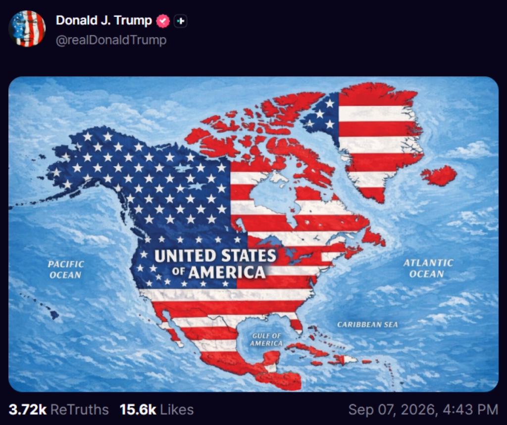
Donald Trump has not publicly expressed a desire to annex Iceland, but during his peech at the World Economic Forum in Davos in January, the POTUS seemed to confuse Greenland and Iceland.
The viral upload contained no written caption or explanation. Even so, key political figures in Reykjavik quickly called for emergency national security meetings to address what many viewed as a direct provocation.
Diplomatic outrage
Icelandic Foreign Minister Thorgerdur Katrin Gunnarsdottir summoned US Ambassador Billy Long. She wanted answers.
According to local media RUV, the Foreign Ministry told local media that officials made their stance clear during the meeting, calling the post “completely inappropriate.”
Social Democratic lawmaker Dagbjort Hakonardottir also pushed back firmly against the graphic online. She urged the government to stand firm against aggressive messaging.
“A friend is one who speaks the truth,” she noted according to DV, adding that “this is not on the table.”