Jens Asbjørn Bøgen
If you’re going to make this kind of manipulation, at least make sure to not do it so blatantly.


If you’re going to make this kind of manipulation, at least make sure to not do it so blatantly.
What is happening?
Russia’s Ministry of Defense published a map on its official Telegram channel, claiming to show the military’s territorial gains in Ukraine since the start of the year.
However, sharp-eyed observers quickly noticed something odd — the map appears to be decades old.
Siversk still called “Yama”
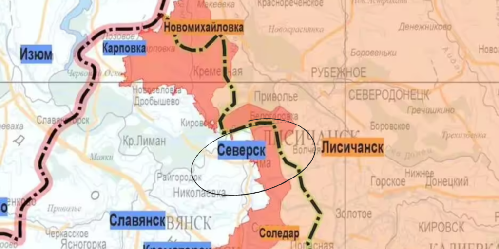
One of the clearest signs of the map’s age is its labeling of the frontline city of Siversk as “Yama” — a name abandoned back in 1973.


Yama was originally founded in the early 1900s and served as an administrative center until 1959, but hasn’t officially gone by that name for over 50 years.
Russian Defense Ministry ignores official name changes

The map also labels Bakhmut as “Bakhmut,” a name Ukraine reinstated, but which Russia refuses to recognize.
Despite this, the Russian military appears to have quietly acknowledged the name on its own materials, creating confusion over the official stance.
More naming confusion
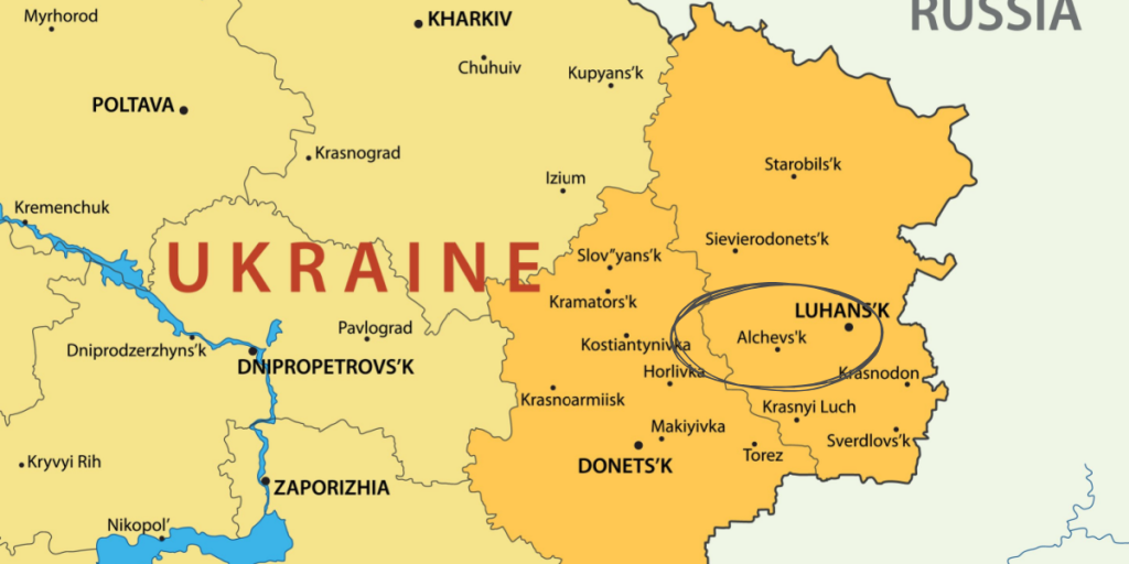
In the Luhansk region, the map refers to the city of Alchevsk — its current name — even though it was known as Kommunarsk from 1961 to 1991.
This inconsistency points to a mix of old and modern place names, further calling the map’s accuracy into question.
Kadiivka: A name with a complicated past
Another example is Kadiivka, a city whose name has changed multiple times.
It was called Stakhanov between 1978 and 2016, and Kadiivka before and after that period.
The choice of name on the map suggests the Defense Ministry might be using a version from before 2016.
A map frozen in time?

These historical naming patterns suggest the Russian Defense Ministry may be relying on a map that’s at least 40 years out of date.
That raises questions about how recent — or credible — the reported territorial gains truly are.
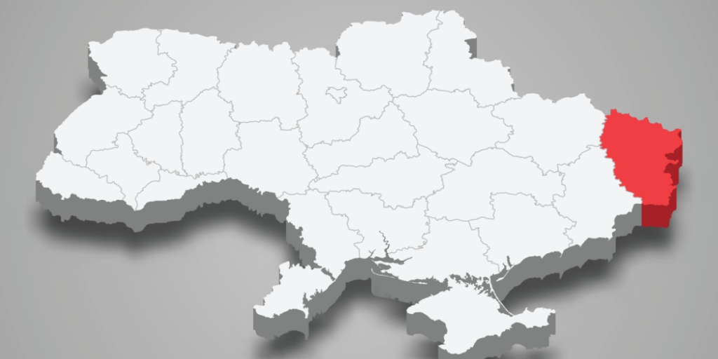
Russia still holds 19% of Ukraine, says Reuters
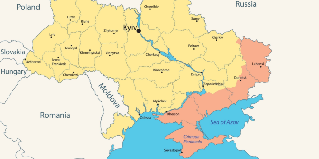
As of August, Russia controls nearly 44,600 square kilometers of Ukrainian land — around 19% of the country.
This includes Crimea, annexed in 2014, and large areas in Ukraine’s east and southeast.
Not the first time

If you think, this sounds familiar, you’re not all wrong, as it’s not the first time, Russia has used outdated maps to prove what their point.
In fact, Russia does this so often, that it has even gotten it’s own name – mapaganda, a play on the words of map and propaganda.
Forging textbooks
In 2023, Russia reworked school atlases and history books to normalize the annexation of Ukrainian regions.
For instance, the new Russian high‑school textbooks depict Zaporizhzhia and Kherson as already part of Russia, even when they are not under permanent Russian control.
Reviving Tsarist-era maps to erase Ukraine’s distinct identity

Going back centuries, Russian cartographic propaganda sought to paint Ukrainian lands as “Little Russia” or part of Muscovy.
Under Peter I, a “Russian Atlas” was produced that labelled parts of modern Ukraine as integral to “Russia.”
These maps made their way into European map markets, subtly shaping Western perceptions of Ukraine’s sovereignty.
Disappearing Ukraine or its borders from media maps

In modern media, maps without Ukraine or with erased borders have circulated as “proof” of Russia’s narrative.
For example, a viral image claimed to be from the German TV channel ZDF’s Heute journal supposedly showed Ukraine with missing territory.
In reality, ZDF clarified that the map aired did include Ukraine’s 1991 borders, with occupied zones merely highlighted, and that the widely shared image was altered.
Misleading claims about Google Maps and erasing Ukrainian identity

Russian propaganda videos have alleged that Ukraine doesn’t appear on Google Maps, aiming to imply its de facto nonexistence.
In truth, Google Maps omits the country name for local cities depending on viewing settings and the user’s location—not because Ukraine is deleted.
Distorting battlefield maps to exaggerate Russian advances
Russia frequently publishes maps of military operations that misrepresent the realities on the ground.
In March 2022, a Russian‑propaganda map claimed full or partial blockades of Kyiv, Chernihiv, Sumy, Kharkiv, and Mykolaiv—and even alleged Russian operations in Odesa via Transnistria.
Independent sources (e.g. the Institute for the Study of War) showed a very different situation: no such sweeping advances.